
 Download PDF
 Download PDF
Market Overview
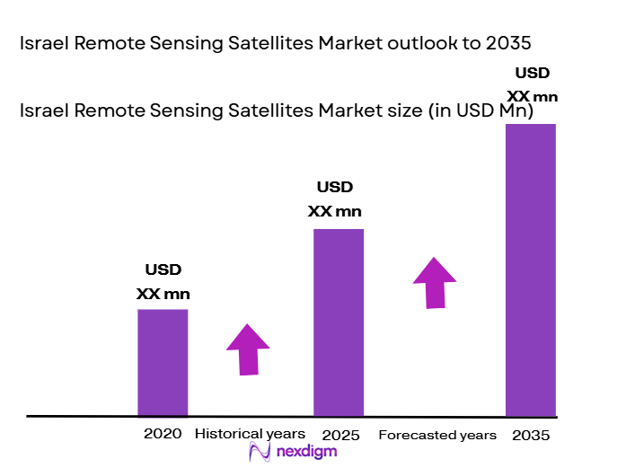
The Israel remote sensing satellites market is driven by advancements in satellite technology, government investments, and an increasing demand for real-time data. Based on a recent historical assessment, the market size for remote sensing satellites is substantial, with a projected value of USD ~ billion in 2024. The growth of this market is underpinned by applications across defense, agriculture, and environmental monitoring sectors. Significant contributions from government initiatives, such as the Israel Space Agency’s investment in satellite infrastructure, fuel further expansion and development. These systems are deployed to address the need for high-resolution imaging, geospatial intelligence, and satellite-based data processing.
Israel is recognized as a key player in the remote sensing satellite market due to its advanced space technology and significant government support. Leading cities, such as Tel Aviv and Herzliya, are at the forefront of innovation in satellite systems, with Israel Aerospace Industries playing a critical role in satellite development and manufacturing. The country has gained international recognition for its expertise in defense applications, contributing to its dominance in the market. Additionally, Israel’s strategic location and partnerships with international organizations strengthen its position as a leader in remote sensing technology.
Market Segmentation
By System Type
The Israel remote sensing satellites market is segmented by product type into optical imaging, synthetic aperture radar (SAR), multispectral imaging, hyperspectral imaging, and thermal imaging systems. Among these, optical imaging systems dominate the market share due to their widespread adoption in earth observation, environmental monitoring, and defense sectors. These systems are preferred for their ability to capture high-resolution images, making them suitable for applications like land use monitoring, disaster management, and agricultural analysis. Their versatility in providing both visible and near-infrared data has also made them a popular choice across various industries, resulting in their dominant position within the market.
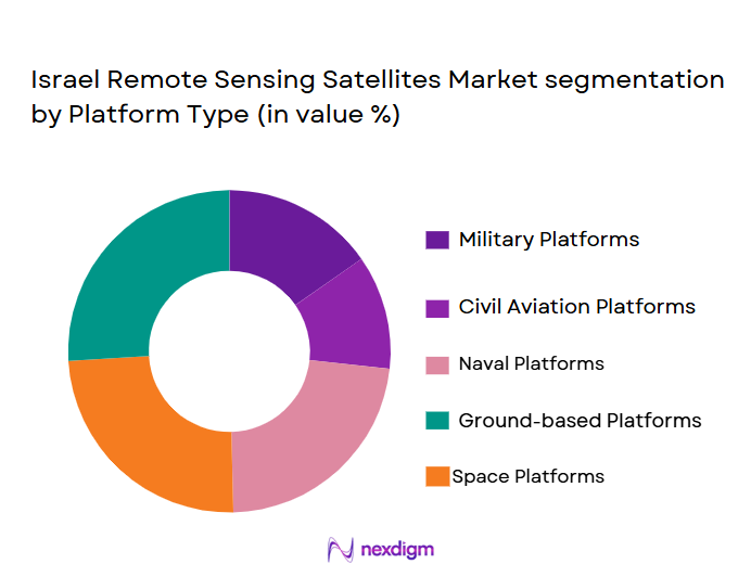
By Platform Type
The market for remote sensing satellites in Israel is segmented by platform type into Low Earth Orbit (LEO), Medium Earth Orbit (MEO), Geostationary Orbit (GEO), CubeSats, and High Altitude Pseudo Satellites (HAPS). The LEO satellites segment holds the dominant market share, owing to their ability to provide high-resolution imagery with shorter revisit times. LEO satellites are essential for applications requiring frequent data updates, such as weather forecasting, disaster management, and agricultural monitoring. Their cost-effectiveness, along with their low latency and smaller size, makes them the preferred choice for Israel’s space agencies and defense contractors, securing their lead in the market.
Competitive Landscape
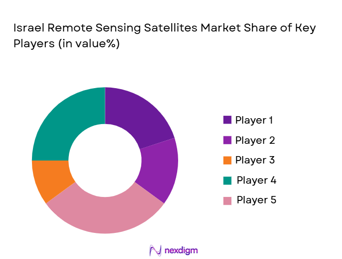
The competitive landscape of the Israel remote sensing satellite market is characterized by significant consolidation, with key players such as Israel Aerospace Industries and Elbit Systems leading the market. These companies benefit from strategic partnerships, government contracts, and a robust technological infrastructure. Their continued dominance is supported by their ability to deliver advanced satellite solutions for both military and civilian applications. The market also sees the rise of startups focusing on cost-effective solutions, though the market remains primarily driven by established defense and aerospace companies.
| Company Name | Establishment Year | Headquarters | Technology Focus | Market Reach | Key Products | Revenue (USD) | Market-Specific Parameter |
| Israel Aerospace Industries | 1953 | Tel Aviv | ~ | ~ | ~ | ~ | ~ |
| Elbit Systems | 1966 | Haifa | ~ | ~ | ~ | ~ | ~ |
| Rafael Advanced Defense Systems | 1948 | Haifa | ~ | ~ | ~ | ~ | ~ |
| MDA (MacDonald, Dettwiler and Associates) | 1969 | Haifa | ~ | ~ | ~ | ~ | ~ |
| SkyFi | 2015 | Tel Aviv | ~ | ~ | ~ | ~ | ~ |
Israel remote sensing satellite Market Analysis
Growth Drivers
Government Investment in Space Infrastructure
Government investment in space infrastructure is a significant driver for the Israel remote sensing satellites market. The Israel Space Agency has made substantial investments in satellite technologies and infrastructure, aiming to expand the country’s capabilities in satellite manufacturing, data collection, and analysis. The government’s involvement in space initiatives is not only focused on military applications but also on civilian sectors, including agriculture and environmental monitoring. Additionally, the Israeli government is fostering partnerships with private companies to develop cost-effective satellite solutions that address various industries’ needs. These investments have contributed to an increase in the country’s satellite launch capabilities and the overall demand for remote sensing technologies. As the government continues to allocate funds to research and development in space technologies, Israel’s leadership in the global satellite market is expected to solidify further. Moreover, government policies that support private sector innovation in space tech will likely result in advancements in satellite technology, boosting the market’s growth. With the government’s active participation and an established regulatory framework, Israel is poised to expand its presence in the global remote sensing satellite market.
Technological Advancements in Satellite Systems
Technological advancements in satellite systems are fueling the growth of the Israel remote sensing satellites market. Over the years, Israel has made significant strides in developing state-of-the-art satellite technology. These advancements, including improved imaging systems, miniaturization of satellite components, and enhanced data processing capabilities, are making satellite systems more efficient and cost-effective. Innovations in AI and machine learning are also improving satellite data analysis, enabling better insights for industries such as agriculture, defense, and urban planning. The development of high-resolution imaging systems and better power management for satellites has made them more reliable and capable of providing real-time data for various applications. The adoption of smaller, lighter satellites, including CubeSats, is allowing for quicker and more frequent launches, further driving the demand for remote sensing solutions. With continuous innovation, the Israeli satellite industry is well-positioned to maintain a competitive edge in the market, fostering further market expansion. These advancements in satellite technology are expected to contribute significantly to market growth, enabling the adoption of remote sensing solutions across multiple sectors.
Market Challenges
High Costs of Satellite Development and Launch
One of the significant challenges in the Israel remote sensing satellites market is the high costs associated with satellite development and launch. Developing advanced satellite systems involves substantial capital investment in research, manufacturing, testing, and launching. The costs of building high-resolution imaging systems and ensuring their durability in space contribute to the overall expenses, making it a barrier for smaller companies and startups. Additionally, the cost of launching satellites, including the need for specialized infrastructure, can make it difficult for players in the market to maintain cost-effective operations. Although the government has been actively investing in space infrastructure, the expense of satellite launches remains a significant challenge for the market. This high cost factor can limit the frequency of launches and the expansion of satellite constellations, potentially hindering market growth. Furthermore, the financial burden of satellite maintenance and the need for skilled personnel in satellite technology adds to the operational expenses of market players, making it challenging for them to stay competitive.
Regulatory Hurdles and Licensing Issues
Regulatory hurdles and licensing issues present a major challenge to the growth of the Israel remote sensing satellites market. Strict regulatory frameworks governing satellite launches, data collection, and space exploration create barriers for companies seeking to enter the market or expand their operations. The need for proper licensing and compliance with both domestic and international regulations can delay satellite launches and increase operational costs. Israel’s regulatory landscape for remote sensing satellites involves obtaining approvals for satellite deployments, ensuring compliance with international space treaties, and securing the necessary clearances for satellite data use. These regulations often require significant time and resources to navigate, adding complexity to the satellite market. As more countries and companies engage in space-based technologies, regulatory complexities are expected to increase, potentially causing delays in satellite projects and limiting the growth potential of the market.
Opportunities
Growing Demand for Earth Observation Data in Agriculture
The growing demand for earth observation data in agriculture presents a significant opportunity for the Israel remote sensing satellites market. As agriculture continues to modernize, the need for precise, real-time data on crop health, soil moisture, and land usage is becoming increasingly vital. Satellite-based remote sensing systems offer an efficient way to monitor large agricultural areas, providing farmers with insights that help optimize productivity and resource usage. Israel’s advanced remote sensing satellite capabilities can cater to the growing need for precision agriculture by offering high-resolution imagery, data analytics, and monitoring systems. This is especially crucial for regions dealing with changing climate conditions, where data-driven insights can help manage water usage, predict crop yields, and address food security concerns. By expanding satellite solutions in the agricultural sector, Israel can contribute to sustainable farming practices while capitalizing on this growing demand for earth observation data. This opportunity for growth will likely drive further investment in remote sensing satellite infrastructure and technology development, benefiting both the agricultural sector and the broader market.
Expanding Defense and Surveillance Applications
Expanding defense and surveillance applications provide a key opportunity for the Israel remote sensing satellites market. Israel has long been a leader in satellite technology for defense purposes, and the increasing global demand for satellite-based surveillance, reconnaissance, and security services is poised to benefit the market. Remote sensing satellites play a critical role in military intelligence, border monitoring, and national security operations. As geopolitical tensions increase and the need for more sophisticated surveillance systems grows, the demand for remote sensing satellites in defense applications will likely increase. Israel, with its expertise in defense technology and satellite systems, is well-positioned to lead the market in providing these services. This growth opportunity is further supported by the Israeli government’s ongoing investments in defense technologies and its commitment to space-related innovation. By capitalizing on the need for advanced defense solutions, Israel’s satellite manufacturers can expand their footprint in the global defense market, opening new avenues for growth and development in remote sensing satellites.
Future Outlook
The future outlook for the Israel remote sensing satellites market is promising, with continued growth expected over the next five years. Technological advancements in satellite systems, increased demand for real-time data, and continued government support will drive the market’s expansion. With a focus on improving satellite launch capabilities and developing cost-effective solutions, Israel is set to maintain its competitive edge in the global space industry. Growing applications in sectors such as agriculture, defense, and environmental monitoring will contribute to the market’s growth, supported by favorable regulations and investments in space infrastructure.
Major Players
• Elbit Systems
• Rafael Advanced Defense Systems
• MDA (MacDonald, Dettwiler and Associates)
• SkyFi
• IAI Space Systems
• Israel Space Agency
• SpacePharma
• Innovative Solutions In Space
• Telesat
• Inmarsat
• GeoIQ
• SpaceX
• Boeing
• Airbus
Key Target Audience
• Government and regulatory bodies
• Defense agencies
• Satellite manufacturing companies
• Agricultural and environmental organizations
• Space technology developers
• Aerospace and defense contractors
• Commercial space operators
Research Methodology
Step 1: Identification of Key Variables
The first step involves identifying the key factors that affect the Israel remote sensing satellites market. This includes understanding the key market segments, technological advancements, and regulatory considerations that influence market dynamics.
Step 2: Market Analysis and Construction
This step involves analyzing the market data collected from primary and secondary sources. It includes building a comprehensive market model, identifying trends, and estimating future growth patterns.
Step 3: Hypothesis Validation and Expert Consultation
Market hypotheses are validated through consultations with industry experts and stakeholders. Their input helps refine assumptions, improve market models, and ensure accurate forecasts.
Step 4: Research Synthesis and Final Output
The final step synthesizes the research findings and presents the complete report, including market trends, forecasts, and strategic insights. The output is validated for accuracy and relevance before publication.
- Executive Summary
- Israel Remote Sensing Satellites Research Methodology
(Definitions, Scope, Industry Assumptions, Market Sizing Approach, Primary & Secondary Research Framework, Data Collection & Verification Protocol, Analytic Models & Forecast Methodology, Limitations & Research Validity Checks)
- Market Definition and Scope
- Value Chain & Stakeholder Ecosystem
- Regulatory / Certification Landscape
- Sector Dynamics Affecting Demand
- Strategic Initiatives & Infrastructure Growth

- Growth Drivers
Increased demand for surveillance and reconnaissance capabilities
Rising investments in environmental monitoring programs
Technological advancements in miniaturization and satellite launch costs - Market Challenges
High costs associated with satellite manufacturing and maintenance
Regulatory hurdles and licensing requirements for satellite launches
Limited availability of skilled workforce in satellite technology sectors - Market Opportunities
Collaborations with private space companies for low-cost satellite solutions
Growing adoption of remote sensing in agriculture for precision farming
Expansion of satellite services in emerging markets and developing countries - Trends
Shift toward smaller, more cost-effective satellite solutions
Growing integration of AI and machine learning for data analysis
Rising demand for real-time data from remote sensing satellites - Government Regulations & Defense Policy
Increased defense budget allocations for satellite-based surveillance
Growing regulatory frameworks for space debris management
Emerging policies for international cooperation in satellite technology - SWOT Analysis (Capability Strengths, Cost Vulnerabilities, Competitive Pressures)
Porter’s Five Forces (Procurement Power, Supplier Concentration, Substitutes, Barriers to Entry)
- By Market Value, 2020-2025
- By Installed Units, 2020-2025
- By Average System Price, 2020-2025
- By System Complexity Tier, 2020-2025
- By System Type (In Value%)
Optical Imaging Systems
Synthetic Aperture Radar (SAR) Systems
Multispectral Imaging Systems
Hyperspectral Imaging Systems
Thermal Imaging Systems - By Platform Type (In Value%)
Low Earth Orbit (LEO) Satellites
Medium Earth Orbit (MEO) Satellites
Geostationary Orbit (GEO) Satellites
CubeSats
High Altitude Pseudo Satellites (HAPS) - By Fitment Type (In Value%)
Standalone Satellites
Satellite Constellations
Integrated Satellite Systems
On-demand Satellite Services
Hybrid Systems - By EndUser Segment (In Value%)
Government & Defense
Environmental Monitoring Agencies
Agricultural Sector
Energy & Utilities
Commercial Enterprises - By Procurement Channel (In Value%)
Direct Sales
Online Platforms
Government Contracts
Third-party Distributors
OEM Partnerships
- Market Share Analysis
- Cross Comparison Parameters
(Market Value, Installed Units, Platform Type, System Type, Fitment Type, Procurement Channels, End-User Segments, Regional Dynamics, Regulatory Landscape) - SWOT Analysis of Key Competitors
- Pricing & Procurement Analysis
- Key Players
Israel Space Agency
Elbit Systems Ltd.
Israel Aerospace Industries (IAI)
SpacePharma
Rafael Advanced Defense Systems
Aerospace Industries Ltd.
GeoIQ
SkyFi
MDA (MacDonald, Dettwiler and Associates)
Innovative Solutions In Space
Dawn Aerospace
Inmarsat
Intelsat
SES S.A.
Telesat
- Government agencies for surveillance and defense
- Environmental organizations for climate and weather monitoring
- Agricultural firms for precision farming technologies
- Private sector companies for geospatial data analytics
- Forecast Market Value, 2026-2035
- Forecast Installed Units, 2026-2035
- Price Forecast by System Tier, 2026-2035
- Future Demand by Platform, 2026-2035


 Request a Sample
 Ask for Customization
 Get a Quote
 Enquire Now