 Download PDF
 Download PDF
Market Overview
The Philippines LiDAR Sensors market is expected to see significant growth driven by technological advancements and increasing demand across various industries such as automotive, construction, and environmental monitoring. The growing need for precise mapping and enhanced vehicle safety is propelling the adoption of LiDAR sensors. Recent historical assessments show the market is driven by government initiatives supporting infrastructure development and the rising demand for autonomous vehicles, which require high-precision sensors. This growth is underpinned by innovations in sensor technology, making them more accessible and cost-effective for broader application across industries.
Key cities like Metro Manila, Cebu, and Davao are dominating the market due to their rapid urbanization and the need for advanced infrastructure systems. These cities are also home to several large-scale construction projects and are key hubs for automotive manufacturing. The demand for LiDAR technology is further amplified by the region’s growing focus on sustainable urban planning and environmental monitoring. As such, these regions are expected to continue leading the market, supported by both private and public sector investments in smart city technologies and modern transportation systems.
Market Segmentation
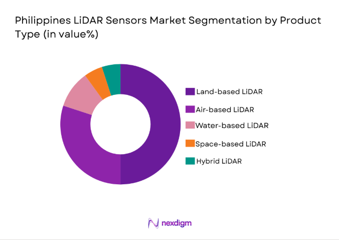
By Product Type
The Philippines LiDAR sensors market is segmented by product type into airborne, terrestrial, mobile, static, and UAV-based systems. Airborne LiDAR dominates due to its ability to cover large areas efficiently, particularly for infrastructure and environmental projects. Its affordability and advancements in drone integration have made it increasingly accessible for various industries.
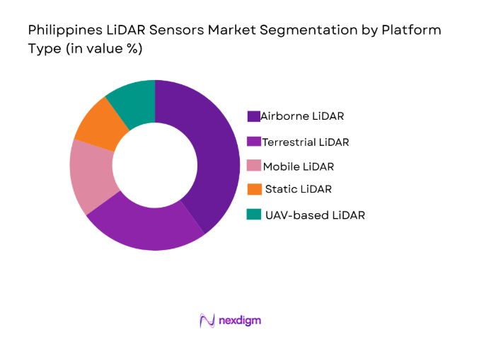
By Platform Type
The market is segmented by platform type into land-based, air-based, water-based, space-based, and hybrid systems. Land-based LiDAR holds a significant share, used for infrastructure and construction surveys, while air-based LiDAR is used for large-scale aerial surveys. UAV-based LiDAR is growing due to its flexibility and cost-effectiveness.
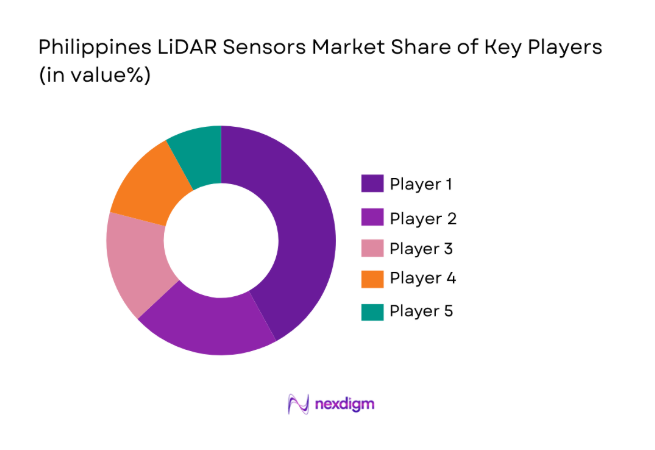
Competitive Landscape
The competitive landscape of the Philippines LiDAR Sensors market is marked by the presence of several global and regional players. Leading companies have focused on technological advancements, with many expanding their product offerings to cater to the increasing demand for high-precision sensors. These companies continue to drive innovation in sensor performance, data accuracy, and integration with other technologies such as AI and machine learning for enhanced mapping solutions. The market is also witnessing strategic partnerships and mergers, further intensifying competition.
| Company Name | Establishment Year | Headquarters | Technology Focus | Market Reach | Key Products | Revenue (USD) | Innovation Focus |
| Velodyne Lidar | 1983 | United States | ~ | ~ | ~ | ~ | ~ |
| Leica Geosystems | 1819 | Switzerland | ~ | ~ | ~ | ~ | ~ |
| Riegl Laser Measurement | 1978 | Austria | ~ | ~ | ~ | ~ | ~ |
| Faro Technologies | 1981 | United States | ~ | ~ | ~ | ~ | ~ |
| Quanergy Systems | 2012 | United States | ~ | ~ | ~ | ~ | ~ |
Philippines LiDAR Sensors Market Analysis
Growth Drivers
Government Infrastructure Projects
The ongoing expansion of infrastructure projects in the Philippines has significantly boosted the demand for LiDAR sensors. The Philippine government has been prioritizing the enhancement of transportation networks, including roads, railways, airports, and seaports. These large-scale infrastructure projects require highly accurate and reliable data to ensure the precision and efficiency of construction work. LiDAR technology is particularly indispensable in providing accurate topographical and spatial data, which is essential for designing and building complex structures. Beyond construction, LiDAR systems support urban planning, flood risk management, and environmental monitoring, enabling the government to make informed decisions that enhance public safety and promote sustainable development. The use of LiDAR technology allows for detailed and timely data collection, which is necessary for large urban development projects, where space and time constraints are often challenging. Additionally, LiDAR technology plays a critical role in supporting the government’s efforts to improve disaster preparedness and response strategies, especially in flood-prone regions. By providing high-resolution data for environmental risk assessments, LiDAR sensors enable the creation of detailed models that can predict flood events and help mitigate their impact on vulnerable populations. Furthermore, as the government continues to modernize the country’s infrastructure, the adoption of advanced technologies like LiDAR will remain a key component in achieving successful project execution. The continuous growth of government infrastructure investments, particularly in transportation and disaster management, will further propel the demand for LiDAR sensors in the coming years.
Technological Advancements in LiDAR Sensors
The rapid advancements in LiDAR sensor technology have been instrumental in driving market growth in the Philippines. Over recent years, innovations in sensor miniaturization, enhanced scanning ranges, and integration with drones and autonomous vehicles have significantly improved the functionality and efficiency of LiDAR systems. The availability of smaller, more affordable LiDAR units, paired with improved capabilities, has made it increasingly accessible to various industries, including agriculture, forestry, environmental monitoring, and urban development. In particular, the integration of LiDAR sensors with unmanned aerial vehicles (UAVs) has opened up new possibilities for aerial mapping, allowing for the surveying of vast areas with minimal human intervention. This is particularly useful in challenging terrains such as forests or mountainous regions, where traditional survey methods may be difficult or costly. Additionally, advancements in laser scanning technologies have resulted in higher-resolution data, allowing for even more precise mapping of land surfaces, vegetation, and structures. As the technology evolves, the market for LiDAR sensors is expected to continue expanding, driven by the increasing demand for high-quality data in a range of applications. The emergence of portable, user-friendly systems, combined with real-time data collection and analysis, has also facilitated the adoption of LiDAR in smaller-scale operations, where it previously might have been too costly or complex to deploy. As these advancements continue to evolve, LiDAR technology will become even more integrated into industries such as construction, infrastructure monitoring, and precision agriculture, thereby fueling continued market growth.
Market Challenges
High Initial Cost of LiDAR Systems
One of the most significant challenges facing the Philippines LiDAR sensors market is the high initial cost associated with the acquisition and deployment of these systems. Although LiDAR technology offers unmatched precision and data quality, the price of high-end systems can be prohibitive, particularly for smaller businesses or organizations in emerging industries like agriculture or construction. The cost of the equipment itself, as well as the need for specialized software and training to operate the systems, makes it a considerable investment. Many industries, especially in rural areas or smaller-scale projects, may find it challenging to justify the high capital expenditure for LiDAR systems, opting instead for less expensive alternatives. The initial costs are especially burdensome for small and medium-sized enterprises (SMEs), which may have limited budgets and may not yet realize the full potential return on investment from adopting such advanced technologies. While the market is expected to evolve with the development of more affordable and accessible systems, the high upfront cost remains a significant barrier to the widespread adoption of LiDAR technology across all sectors. This is particularly true in areas such as precision agriculture, where small farmers may not have the financial capacity to invest in LiDAR-equipped drones or ground-based scanning systems. In response, some companies are exploring rental or subscription-based models to help make the technology more accessible to a wider range of industries and end-users, but these models are still in their early stages.
Lack of Skilled Workforce
Another significant challenge in the Philippines LiDAR sensors market is the shortage of skilled professionals who can effectively operate, process, and interpret data generated by LiDAR systems. While the technology itself is increasingly accessible, the ability to maximize its value requires a high level of expertise in data analysis and geospatial science. LiDAR data can be complex and requires specialized knowledge to process and extract meaningful insights, such as mapping terrain, vegetation, and structures accurately. Unfortunately, there is a limited pool of trained professionals in the Philippines who possess the necessary skills to fully harness the potential of LiDAR technology. The lack of qualified personnel is a major obstacle for companies wishing to integrate LiDAR into their operations, particularly in sectors such as construction, environmental monitoring, and agriculture. Furthermore, companies often face the challenge of training existing staff or hiring external experts, which can add to project costs and timelines. This skill gap also hinders the adoption of LiDAR technology in more niche or emerging sectors, where specialized knowledge is required to apply the data effectively. In the long term, it will be crucial to address this skills shortage through educational initiatives, certifications, and specialized training programs, enabling professionals to develop the expertise required to work with LiDAR systems and interpret the resulting data accurately.
Opportunities
Integration with Autonomous Vehicles
One of the most promising opportunities for the Philippines LiDAR sensors market is the increasing demand for autonomous vehicle technology. As the global automotive industry pushes towards the development of fully autonomous vehicles, LiDAR technology is a critical enabler of this transformation. LiDAR sensors provide high-resolution, 360-degree views of the environment, allowing self-driving cars to detect obstacles, map their surroundings, and navigate safely. In the Philippines, the growing interest in smart cities and sustainable transportation solutions is likely to drive the adoption of autonomous vehicles, creating an opportunity for LiDAR technology to play a key role in the country’s future transportation systems. LiDAR sensors are already widely used in autonomous vehicle prototypes around the world, and as the Philippines explores the potential for self-driving vehicles, the demand for precise, real-time data collection will only increase. The government’s ongoing investments in transportation infrastructure modernization, combined with the rise of electric vehicles (EVs), offers a favorable environment for the deployment of autonomous technologies. This presents a significant opportunity for LiDAR manufacturers to expand their reach and cater to the growing needs of the automotive industry in the Philippines. Furthermore, the integration of LiDAR with other technologies, such as artificial intelligence (AI) and machine learning, will enhance the ability of autonomous vehicles to make decisions, enabling the market for LiDAR sensors to grow significantly in the coming years.
Agriculture and Forestry Applications
The agricultural sector in the Philippines offers another substantial opportunity for LiDAR sensors, particularly in precision agriculture and forest management. LiDAR technology is increasingly being used in these sectors for land surveying, crop health monitoring, and environmental management. By providing high-resolution data on topography, vegetation density, and land features, LiDAR systems enable better resource management and decision-making in agriculture and forestry. The ability to map large areas quickly and accurately allows farmers to optimize irrigation systems, monitor crop growth, and detect potential issues such as soil erosion or water scarcity. In forestry, LiDAR technology aids in forest inventory management, monitoring tree health, and assessing the impact of deforestation. The Philippines, with its large agricultural and forested areas, stands to benefit significantly from the adoption of LiDAR in these sectors. As the country seeks to modernize its agricultural practices and promote sustainable land use, the demand for LiDAR sensors is expected to increase. Furthermore, with the growing focus on environmental conservation and the sustainable management of natural resources, LiDAR’s ability to provide detailed data on vegetation, land contours, and topography makes it an invaluable tool for improving the country’s agricultural and forestry practices, while addressing challenges such as deforestation and land degradation. As the market matures, LiDAR adoption is expected to expand across the agricultural and forestry industries, creating new growth opportunities for the technology.
Future Outlook
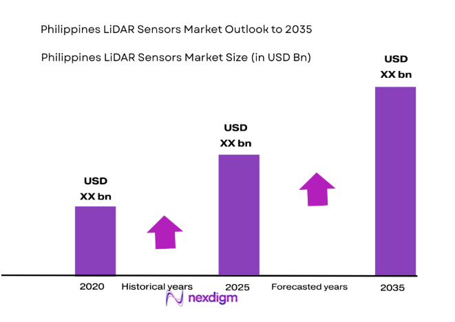
The Philippines LiDAR Sensors market is expected to experience continued growth over the next five years. This growth will be driven by increasing government investments in infrastructure development, technological advancements in LiDAR systems, and expanding applications across sectors like automotive, construction, and environmental monitoring. With continuous improvements in sensor technology, LiDAR solutions are becoming more accessible and cost-effective for a wider range of industries. As autonomous vehicles, smart cities, and environmental sustainability projects gain momentum, the demand for high-precision LiDAR sensors will rise, presenting a promising future outlook for the market.
Major Players
- Velodyne Lidar
- Leica Geosystems
- Riegl Laser Measurement Systems
- Faro Technologies
- Quanergy Systems
- Teledyne Optech
- LeddarTech
- SICK AG
- Topcon Positioning Systems
- Geoslam
- Hokuyo Automatic Co.
- Phoenix LiDAR Systems
- LiDARUSA
- Voxdale
- Geo-matching
Key Target Audience
- Investments and venture capitalist firms
- Government and regulatory bodies
- Automotive manufacturers
- Construction and infrastructure companies
- Environmental agencies
- Aerospace and defense contractors
- Agricultural technology firms
Research Methodology
Step 1: Identification of Key Variables
In this step, the key variables affecting the market are identified, including technological advancements, market demand, and regulatory influences.
Step 2: Market Analysis and Construction
Comprehensive analysis of the market is conducted, including segmentation, competitive landscape, and demand-side factors.
Step 3: Hypothesis Validation and Expert Consultation
Data is validated by consulting with industry experts and stakeholders, ensuring the accuracy of the market assumptions.
Step 4: Research Synthesis and Final Output
The research findings are synthesized into a final report, presenting the market outlook and actionable insights for stakeholders.
- Executive Summary
- Research Methodology (Definitions, Scope, Industry Assumptions, Market Sizing Approach, Primary & Secondary Research Framework, Data Collection & Verification Protocol, Analytic Models & Forecast Methodology, Limitations & Research Validity Checks)
- Market Definition and Scope
- Value Chain & Stakeholder Ecosystem
- Regulatory / Certification Landscape
- Sector Dynamics Affecting Demand
- Strategic Initiatives & Infrastructure Growth

- Growth Drivers
Government investments in smart infrastructure
Rising demand for autonomous vehicles
Technological advancements in LiDAR sensors - Market Challenges
High initial cost of LiDAR systems
Limited availability of skilled workforce
Regulatory and compliance barriers - Market Opportunities
Expansion of smart city initiatives
Integration of LiDAR with other sensor technologies
Growing demand in environmental monitoring - Trends
Adoption of LiDAR in autonomous vehicles
Integration of LiDAR in agriculture for precision farming - Government Regulations
Data protection and privacy regulations
Export control and compliance policies
Government funding and grants for advanced technologies - SWOT Analysis
- Porter’s Five Forces
- By Market Value, 2020-2025
- By Installed Units, 2020-2025
- By Average System Price, 2020-2025
- By System Complexity Tier, 2020-2025
- By System Type (In Value%)
Scanning LiDAR Systems
Imaging LiDAR Systems
Topographic LiDAR Systems
Bathymetric LiDAR Systems
Airborne LiDAR Systems - By Platform Type (In Value%)
Ground-Based Platforms
Aerial Platforms
Marine Platforms
Mobile Platforms
Drone-Based Platforms - By Fitment Type (In Value%)
On-premise Solutions
Cloud-based Solutions
Hybrid Solutions
Integrated Solutions - By End User Segment (In Value%)
Automotive Industry
Construction & Civil Engineering
Environmental & Geological Applications
Defense & Aerospace
Agriculture
- Market Share Analysis
- Cross Comparison Parameters (System Type, Platform Type, End User Segment, Fitment Type, Procurement Channel, Pricing, Technology, Regulation, Market Dynamics, Competition)
- SWOT Analysis of Key Competitors
- Pricing & Procurement Analysis
- Key Players
Velodyne Lidar
Leica Geosystems
Riegl Laser Measurement Systems
Teledyne Optech
Faro Technologies
Quanergy Systems
LeddarTech
SICK AG
Topcon Positioning Systems
Geoslam
Hokuyo Automatic Co.
Phoenix LiDAR Systems
LiDARUSA
Voxdale
Geo-matching
- Automotive industry’s growing interest in LiDAR
- Construction sector adoption of LiDAR for surveying
- Defense sector’s use of LiDAR in surveillance
- Agriculture sector’s growing reliance on precision farming
- Forecast Market Value, 2026-2035
- Forecast Installed Units, 2026-2035
- Price Forecast by System Tier, 2026-2035
- Future Demand by Platform, 2026-2035


 Request a Sample
 Ask for Customization
 Get a Quote
 Enquire Now